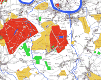
Explore a section of the redrawn map by moving your mouse pointer around the small thumbnail below. This section shows the area around Wimbledon.
Note that the quality (and size) of the actual prints far exceeds the preview you see here.
Planned from a scale of one mile to an inch, first published 1788, digitally redrawn by Andrew Macnair, 2009.
Explore a section of the redrawn map by moving your mouse pointer around the small thumbnail below. This section shows the area around Wimbledon.
Note that the quality (and size) of the actual prints far exceeds the preview you see here.
All content © 2009 - 2026 Andrew Macnair
Web site by Vantech Media![]()
00000335